19 High Street: Difference between revisions
No edit summary |
No edit summary |
||
| Line 19: | Line 19: | ||
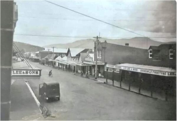
[[File:Zzz_Browne's_Store_011143.jpg|600px|thumb|left|Browne's Furniture Store 1920s. The awning of [[16 High Street|JF Lee & Sons]] is visible on the left - built in 1912. [[27-29 High Street|29 High Street]], seen to the left, was built in 1921. Originally this photo was incorrectly dated and published as being from 1855. The building dates from 1856 but the photo is from the 1920s.]] | [[File:Zzz_Browne's_Store_011143.jpg|600px|thumb|left|Browne's Furniture Store 1920s. The awning of [[16 High Street|JF Lee & Sons]] is visible on the left - built in 1912. [[27-29 High Street|29 High Street]], seen to the left, was built in 1921. Originally this photo was incorrectly dated and published as being from 1855. The building dates from 1856 but the photo is from the 1920s.]] | ||
[[File:High_Street_19_Streetscape.jpg|600px|thumb|left|Streetscape showing JF Lee & Sons Furniture at number 19 and surrounding buildings]] | [[File:High_Street_19_Streetscape.jpg|600px|thumb|left|Streetscape showing JF Lee & Sons Furniture at number 19 and surrounding buildings]] | ||
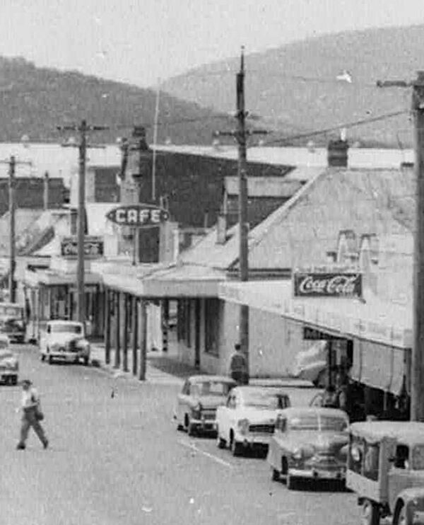
[[File:High_Street_19_1950s.jpg|600px|thumb|left|View of 19 High Street and surrounding shops in an Ash Bester postcard | [[File:High_Street_19_1950s.jpg|600px|thumb|left|View of 19 High Street and surrounding shops in the 1950s from an Ash Bester postcard.]] | ||
[[File:High_Street_19_demolition_1967_Damian_Bester.jpg|600px|thumb|left|Demolition of the century old building in 1967 - the site was used as a car park for a couple of years until a new building was erected. (Photo courtesy of Damian Bester)]] | [[File:High_Street_19_demolition_1967_Damian_Bester.jpg|600px|thumb|left|Demolition of the century old building in 1967 - the site was used as a car park for a couple of years until a new building was erected. (Photo courtesy of Damian Bester)]] | ||
[[File:High_Street_19_Corner_Capers_(2006).jpg|600px|thumb|left|Corner Capers Internet Cafe in 2006 (Photo courtesy of New Norfolk Historical Information Centre)]] | [[File:High_Street_19_Corner_Capers_(2006).jpg|600px|thumb|left|Corner Capers Internet Cafe in 2006 (Photo courtesy of New Norfolk Historical Information Centre)]] | ||
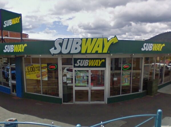
[[File:High_Street_19_Subway_(2009).jpg|600px|thumb|left|Subway in 2009 (Photo courtesy of Google Maps)]] | [[File:High_Street_19_Subway_(2009).jpg|600px|thumb|left|Subway in 2009 (Photo courtesy of Google Maps)]] | ||
Revision as of 12:02, 18 October 2024
← 17 High Street - ◦ - 25 High Street →
- Ikey Solomon is reputed to have run a tobacconist on this site between 1835 and 1838
- JJ Wilshire’s Derwent Stores (1856 - 1872)
- McGough & Andrewartha Emporium (-1895 - 1909)
- Scarr's Happy Home Store (manager Frank Brown) (-1913 - 1919+)
- Lee and Sons
- VD Lee's Ironmongery
- Tipper Lee Hardware
- Demolished (1967)
- Kenny Chan (1976? - ?)
- Lucki's Takeaway (1993)
- Corner Capers
- Subway
Although the street address for this site is now 19 High Street, the land title is officially 34 & 34a Burnett Street and shows as such on List Maps and title search.


