81 High Street: Difference between revisions
No edit summary |
No edit summary |
||
| (29 intermediate revisions by the same user not shown) | |||
| Line 1: | Line 1: | ||
← [[79 High Street]] - ◦ - [[87 High Street]] → | ← [[79 High Street]] - ◦ - [[87 High Street]] → | ||
* Commercial Bank ( | There were two shops on this site before they were demolished to make way for the petrol station. | ||
'''SHOP 1 - closest to Star & Garter''' | |||
* Commercial Bank (-1916+) | |||
'''SHOP 2 - corner of Stephen Street''' | |||
* Col Brown's Chemist (1903 - 1930+) | * Col Brown's Chemist (1903 - 1930+) | ||
* ES&A Bank (ANZ) | * Tobacconist (early 1930s?) | ||
* Hairdresser (late 1930s?) | |||
* ES&A Bank (ANZ)? | |||
'''DEMOLISHED''' | |||
* Service Station | * Service Station | ||
[[File:High_Street_51a_CJ_Brown_Chemist_Circa_1910.jpg|600px|thumb|left|Colin Brown's Chemist and residence on the corner of High and Stephen Street circa 1910]] | |||
[[File:High_Street_51a_CJ_Brown_Chemist_Circa_1910.jpg|600px|thumb|left| | |||
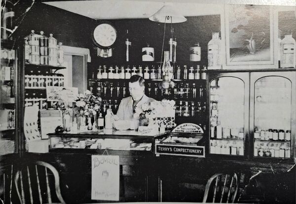
[[File:High_Street_85_interior.jpg|600px|thumb|left|Pharmacy interior with Colin Brown circa 1910. (Photo courtesy of Jan Ryder)]] | [[File:High_Street_85_interior.jpg|600px|thumb|left|Pharmacy interior with Colin Brown circa 1910. (Photo courtesy of Jan Ryder)]] | ||
[[File:High_Street_Arthur_Square_1930s_(Alanna_Broadby).jpg|600px|thumb|left|View of Arthur Square from the balcony of Smith's Hotel - not sure when this was taken but assuming 1930s. From the awning, we can see that the pharmacy is now a tobacconist (Photo courtesy of Alanna Broadby)]] | |||
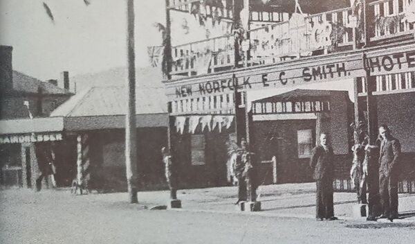
[[File:High_Street_81_Hairdresser.jpg|600px|thumb|left| | [[File:High_Street_81_Hairdresser.jpg|600px|thumb|left|The tobacconist is now a hairdresser - if the hotel is decorated for the coronation of George VI, that would date it to 1937.]] | ||
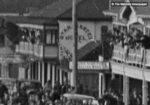
[[File:High_Street_81_Streetscape_1953_Mercury.jpg|600px|thumb|left|A glimpse of the E S & A Bank between the Star & Garter and Smith's Hotel, during the Coronation Parade in 1953 (Photo courtesy of the Mercury)]] | |||
[[File:High_Street_89_Star_and_Garter_02.jpg|600px|thumb|left|The small building next to the Star & Garter became the Commercial Bank some time around 1916]] | |||
[[File:High_Street_81_Commercial_Bank_(circa_1915).jpg|600px|thumb|left|Commercial Bank around 1916 (Photo courtesy of the New Norfolk Historical Information Centre)]] | |||
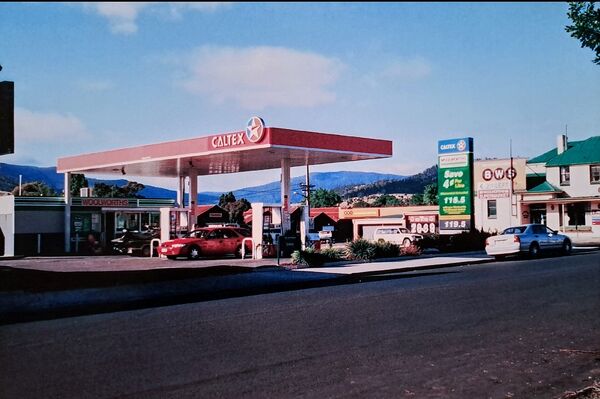
[[File:High_Street_81_Caltex_(2006).jpg|600px|thumb|left|Caltex Service Station in 2006 (Photo courtesy of New Norfolk Historical Information Centre)]] | |||
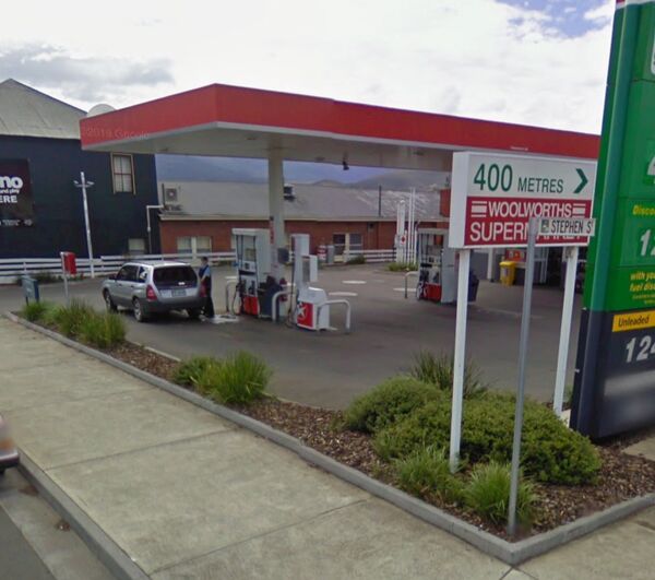
[[File:High_Street_81_Garage_2009.jpg|600px|thumb|left|Service Station in 2009 (Photo courtesy of Google Maps)]] | |||
Latest revision as of 12:57, 5 August 2024
← 79 High Street - ◦ - 87 High Street →
There were two shops on this site before they were demolished to make way for the petrol station.
SHOP 1 - closest to Star & Garter
- Commercial Bank (-1916+)
SHOP 2 - corner of Stephen Street
- Col Brown's Chemist (1903 - 1930+)
- Tobacconist (early 1930s?)
- Hairdresser (late 1930s?)
- ES&A Bank (ANZ)?
DEMOLISHED
- Service Station

